A cable percussion rig drops a heavy steel cutter into the stiff glacial clay of Beaumont Leys, and the sampler returns with a dark grey core that still smells faintly of the River Soar's old floodplain. That core, logged at 6.2 metres depth, is what a pile foundation design in Leicester actually depends on—not generic bearing capacity tables, but physical evidence from the exact postcode where the load will land. The city's geology is deceptively variable: Mercia Mudstone Group bedrock sits shallow in the east, while deep alluvial deposits follow the Soar corridor west through Abbey Park toward the city centre. Designing driven or bored piles here means reconciling BS EN 1997-1 limit state philosophy with site-specific stratigraphy, and the only way to get that stratigraphy right is with high-quality borehole recovery and properly executed in-situ tests. When the mudstone is weathered near the surface it can soften into a stiff clay that confuses inexperienced loggers, and that mistake translates directly into overdesigned or underdesigned piles.
A pile design is only as sound as the stratigraphic log it rests on, and in Leicester's layered drift deposits that log demands physical verification, not desk-study assumptions.
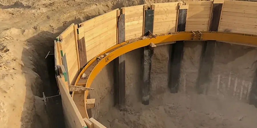
Local considerations
The east-west geological contrast across Leicester creates a risk profile that catches out engineers unfamiliar with the Midlands. East of the A6 toward Humberstone the mudstone is shallow and competent, and piles typically find refusal within 15 metres. But west of the Soar—around West Bridge and the old textile mill sites—thick sequences of soft alluvium and made ground overlie the bedrock, sometimes exceeding 10 metres of compressible material. In these zones, negative skin friction becomes the controlling design case, and ignoring it leads to unacceptable downdrag on the pile shaft. The worst scenario we have reviewed involved a warehouse extension where the original investigation stopped at 8 metres in fill without reaching the mudstone, and the resulting piles settled differentially by more than 40 mm within the first year of operation. Leicester's industrial archaeology, with buried foundations and backfilled mill races, adds another layer of uncertainty that only targeted investigation and conservative shaft resistance assumptions can handle.
Regulatory framework
BS EN 1997-1:2004 + UK National Annex (Geotechnical design – General rules), BS EN 1997-2:2007 (Ground investigation and testing), BS 5930:2015+A1:2020 (Code of practice for ground investigations), ICE Specification for Piling and Embedded Retaining Walls (3rd edition, 2017), CIRIA Report C574 (Engineering in Mercia Mudstone)
Common questions
How deep do piles typically need to go in Leicester city centre?
Pile depths in central Leicester vary significantly by postcode. East of the Soar, bored piles often terminate within 12–15 metres in competent Mercia Mudstone. West of the river, through the alluvial corridor, depths of 18–22 metres are common to bypass soft clays and reach the underlying bedrock. The exact depth is determined by ground investigation boreholes logged to BS 5930 standards, not by rule-of-thumb estimates.
What is the typical cost range for a pile foundation design package in Leicester?
For a medium-scale residential or commercial project in Leicester, the geotechnical design package—including investigation specification, interpretive report, pile design calculations, and construction drawings—typically falls between £1,390 and £5,260 depending on the number of piles, complexity of ground conditions, and whether independent checking is required.
Do you use CPT or SPT data for pile design on Mercia Mudstone sites?
We use both, but CPT data is preferred for shaft resistance calibration in the granular superficial deposits that overlie the mudstone in Leicester. For the Mercia Mudstone itself, SPT N-values and laboratory unconfined compressive strength tests on recovered core provide the primary design inputs, interpreted through the β method and confirmed against local pile load test databases.
How does the River Soar affect pile design in nearby sites?
The Soar floodplain deposits—soft to firm alluvial silts and clays—introduce two design challenges: low shaft resistance in the upper metres and the potential for negative skin friction if the surrounding ground settles more than the pile. We account for this by calculating downdrag forces explicitly and by extending piles through the alluvium into the underlying mudstone or dense gravel, ensuring the neutral plane sits within a competent bearing stratum.
What deliverables do I receive from a pile foundation design commission?
The final package includes a geotechnical interpretive report, pile load capacity and settlement calculations, pile schedule with lengths and reinforcement details, pile cap design notes, and a construction specification aligned with the ICE Specification for Piling. We also provide a design certificate signed by a Chartered Civil Engineer registered with the Engineering Council.