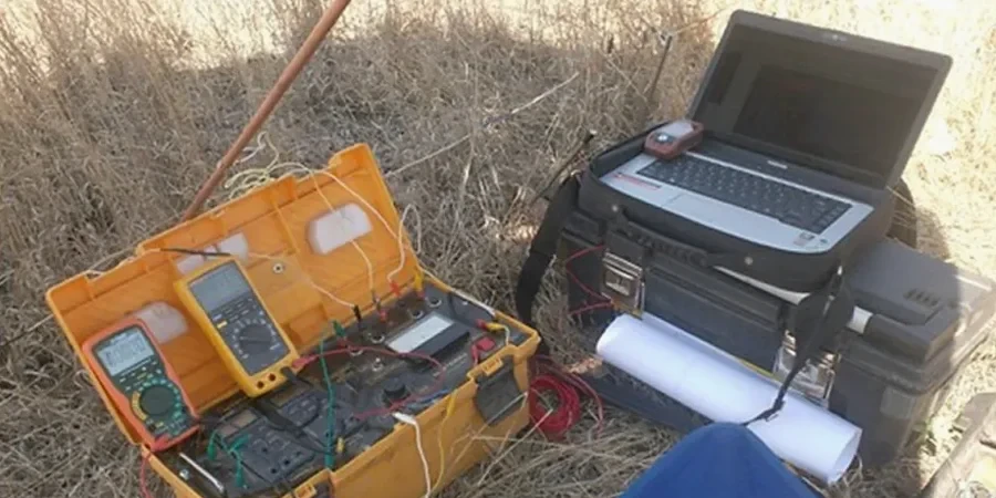
Leicester sits on a complex mix of Mercia Mudstone, river terrace gravels, and glacial till. We see it on site every week: what looks like uniform ground on a borehole log often hides a paleochannel or a buried service trench that standard drilling misses. Electrical resistivity fills that gap. A VES survey maps vertical changes in apparent resistivity, picking out clay bands, sand lenses, and water tables without digging a single pit. For brownfield sites in the Soar Valley, where industrial backfill can vary over just a few metres, combining a CPT test with a resistivity profile gives the full picture before a single foundation is designed. The method works fast: a typical VES sounding takes under an hour, and the inverted model tells us where the competent bearing stratum really starts. We run the survey, process the data with RES2DINV, and deliver a cross-section you can hand straight to the structural engineer. No guesswork, no surprises during excavation.
Resistivity does not replace a borehole — it tells you where to put the borehole and what to expect between them.
Common questions
What does a VES survey cost in Leicester?
For a typical Leicester site, a single VES sounding ranges from £460 to £710 depending on the target depth and access conditions. A 2D resistivity line with multiple electrodes generally falls in the same range per line for small to medium spreads. We provide a fixed-price proposal after reviewing your site location and investigation objectives.
How deep can resistivity testing reach in Leicester's geology?
With a standard 100-metre Wenner spread, we routinely reach 20 to 25 metres depth in the Mercia Mudstone and river terrace deposits around Leicester. Greater depths are achievable with longer cable spreads, though urban site constraints often limit the maximum array length. For depths beyond 30 metres, we typically recommend combining VES with deeper borehole methods.
Can resistivity detect contamination on a Leicester brownfield site?
Yes, with the right contrast. Leachate from old landfill or hydrocarbon spills typically shows as a low-resistivity anomaly because dissolved ions increase the pore fluid conductivity. We have mapped former gasworks contamination along the Soar corridor this way. The method works best when background resistivity is well-characterised from clean areas of the same site, and results are validated with chemical sampling from targeted boreholes.